7 restaurantes ideais para os amantes de francesinha
As famosas francesinhas, são um dos pratos mais típicos e conhecidos da cidade do Porto.
Acredito, que nenhum turista visita a cidade do Porto sem provar esta iguaria.
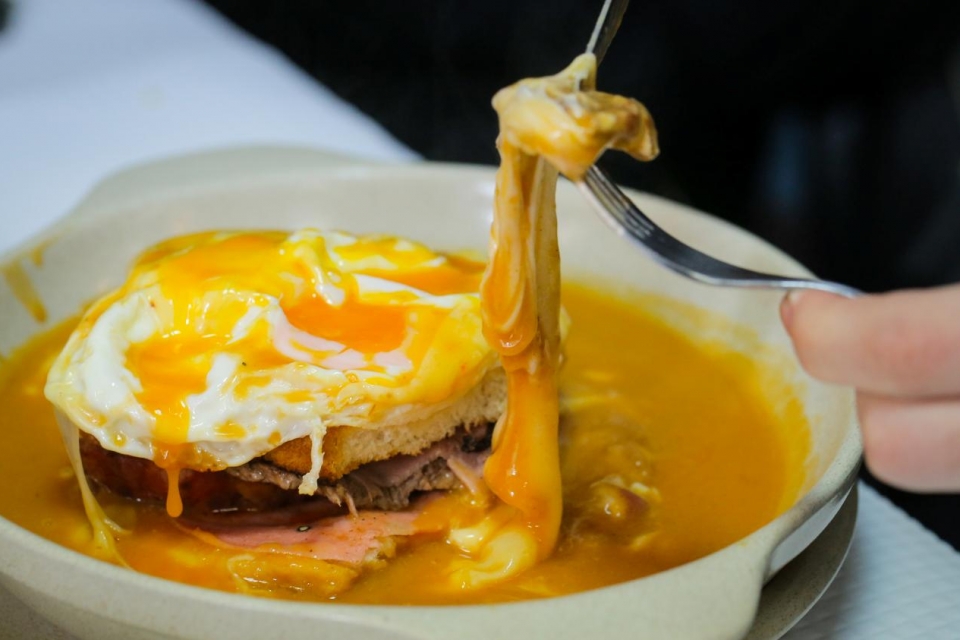
A francesinha surgiu pelas mãos de um português chamado David Silva que nos anos de 1950 criou o sanduíche, inspirado no Croque-Monsieur francês. Contudo, na iguaria criado por David, o elemento secreto e mais apreciado é o molho, que ainda hoje é segredo na maioria dos restaurantes da especialidade.
Mas afinal onde se comem as melhores francesinhas do Porto?
Segundo vários sites e a opinião de várias pessoas, estes são alguns dos restaurantes onde se comem as melhores francesinhas.
1. Brasão Cervejaria
Existem vários espaços deste restaurante, tanto no Porto como em Gaia, sendo conhecido pelas suas francesinhas no forno muito bem recheadas, e pela variedade de cervejas disponíveis.
2. O Afonso
Quando se fala de francesinhas, este restaurante é uma referência (até Anthony Bourdain aqui provou este famoso prato, em fevereiro de 2017). Aqui destaca-se o pão torrado, a carne e as batatas que enchem o prato.
3. Café Santiago
Este é talvez um dos nomes mais sonantes quando se fala em francesinhas. Fundando em 1959, o café é conhecido pelos seus ingredientes frescos, (muitos deles vem do mercado do Bolhão), e claro pelo molho que se tornou destaque deste local.
4. Capa Negra II
Outro ícone que vem à mente das pessoas quando o assunto é francesinhas, é o Capa Negra II. Por lá a receita tradicional continua a ser a preferida de todos, mas, nem por isso, o restaurante deixa de apresentar opções que agradem a todos.
5. A Regaleira
Foi aqui que David da Silva, criou e apresentou a famosa francesinha. Só por aí já merece o seu destaque, e desde então mantém a receita tradicional que ainda hoje faz sucesso.
6. O Golfinho
Aqui somos convidados a comer ao balcão, e desfrutar de uma francesinha com tudo a que se tem direito de uma forma relaxada e descontraída.
7. Barcarola Café
A história do Barcarola conta já com mais de quatro décadas, e hoje é considerado um dos melhores restaurantes para se comer francesinha. Aqui, além da receita tradicional, é possível encontrar outras opções como, por exemplo, a receita vegetariana.

